
Last Natural Snow of Slovakia
Hiking through Slovakian High Tatras
Chapter I / I
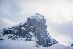
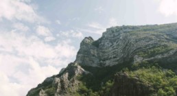
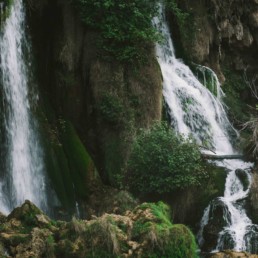
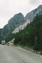
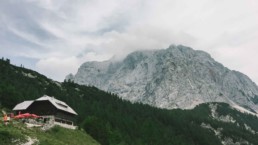
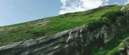
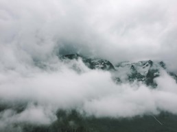
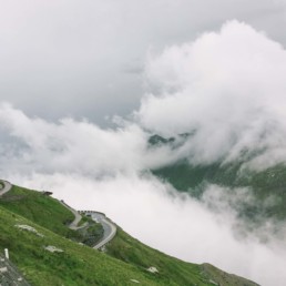
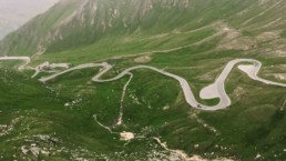
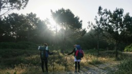
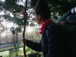
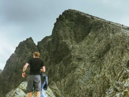
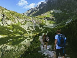
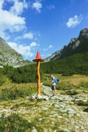
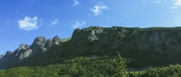
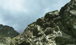
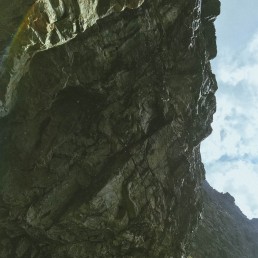
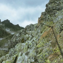
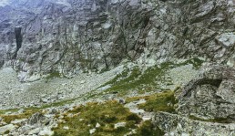
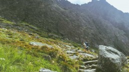
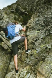
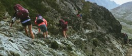
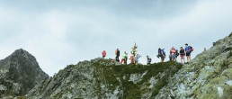
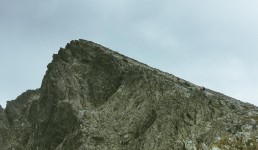
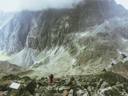
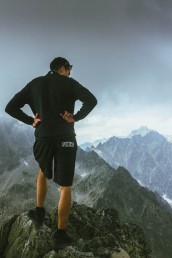
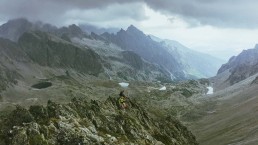
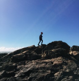
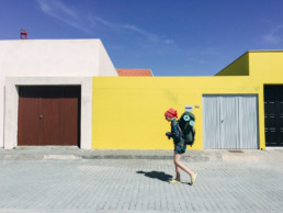
An exceptionally attractive trip is the ascent to the Kriváň Mt. (2,494 m ) a stout peak in the western part of the High Tatras. This mountain is a multiple winner of enquiries about the mountain in Slovakia. It is easily recognisable for its conspicuously curved summit, which is the reason why it is called Kriváň (in English Curved Mount).
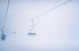
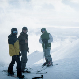
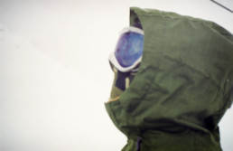
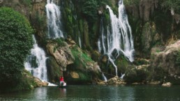
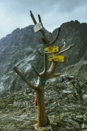
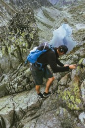
The most comfortable and quick way to reach the top of Kriváň starts at the point called Tri studničky. The first serpentines of the green-marked footpath bring tourists to a place called Grúnik, which witnessed some bitter fighting between the partisans and the Nazi troops at the end of the Second World War. The path goes on from Grúnik crossing the slope of the Priehyba Mt. to a steep trough covered by falling debris from the Kriváň.
An exceptionally attractive trip is the ascent to the Kriváň Mt. (2,494 m ) a stout peak in the western part of the High Tatras. This mountain is a multiple winner of enquiries about the mountain in Slovakia. It is easily recognisable for its conspicuously curved summit, which is the reason why it is called Kriváň (in English Curved Mount).
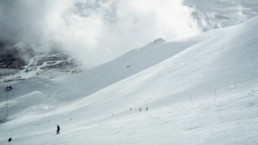
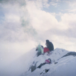
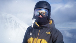
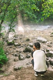
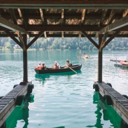
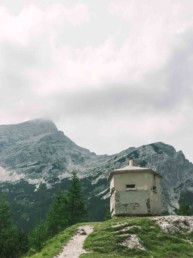
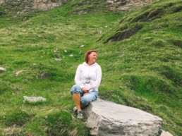
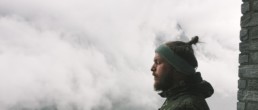
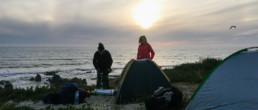
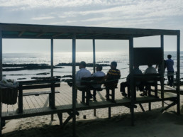
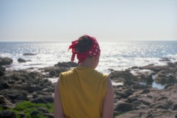
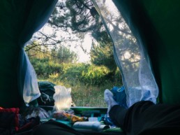
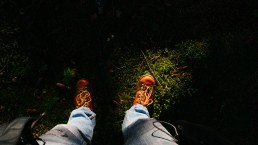
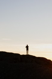
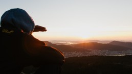
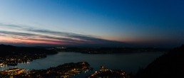
Not the most comfortable place to sleep, but it was worth it for the view.
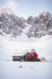
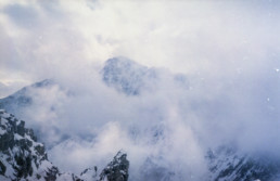
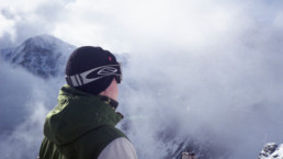
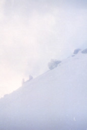
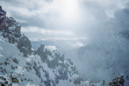
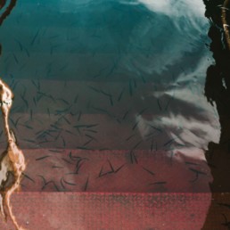
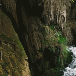
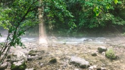
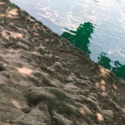
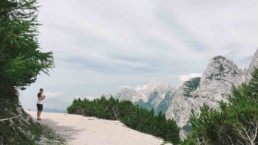
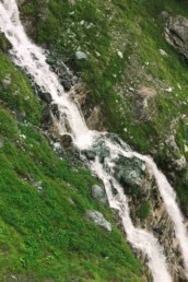
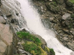
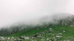
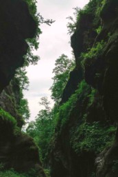
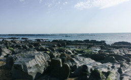
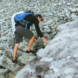
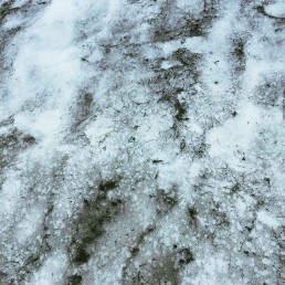
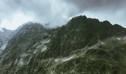
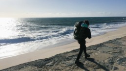
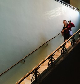
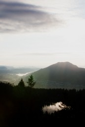
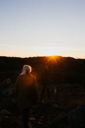
The last bits of the snow for this year.
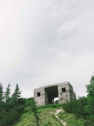
Not the most comfortable place to sleep, but it was worth it for the view.
The End.
share if you like
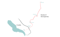
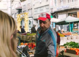
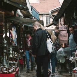
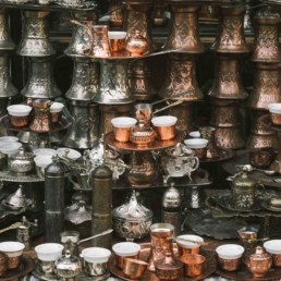
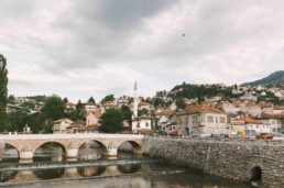
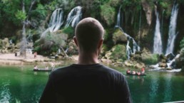
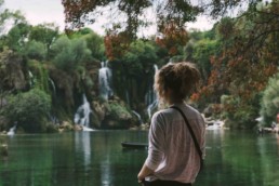
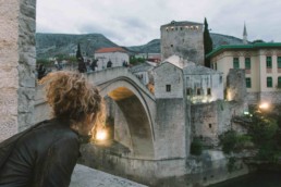
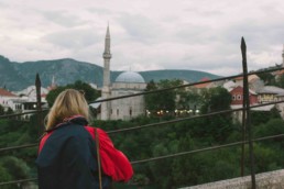
Bosnia & Herzegovina
Hiking through Slovakian High Tatras
Chapter I / I
An exceptionally attractive trip is the ascent to the Kriváň Mt. (2,494 m ) a stout peak in the western part of the High Tatras. This mountain is a multiple winner of enquiries about the mountain in Slovakia. It is easily recognisable for its conspicuously curved summit, which is the reason why it is called Kriváň (in English Curved Mount).

The most comfortable and quick way to reach the top of Kriváň starts at the point called Tri studničky. The first serpentines of the green-marked footpath bring tourists to a place called Grúnik, which witnessed some bitter fighting between the partisans and the Nazi troops at the end of the Second World War. The path goes on from Grúnik crossing the slope of the Priehyba Mt. to a steep trough covered by falling debris from the Kriváň.

An exceptionally attractive trip is the ascent to the Kriváň Mt. (2,494 m ) a stout peak in the western part of the High Tatras. This mountain is a multiple winner of enquiries about the mountain in Slovakia. It is easily recognisable for its conspicuously curved summit, which is the reason why it is called Kriváň (in English Curved Mount).
Not the most comfortable place to sleep, but it was worth it for the view.
The last bits of the snow for this year.
Not the most comfortable place to sleep, but it was worth it for the view.
The End.
share if you like
Central Europe
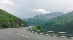
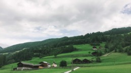
Round trip through Central Europe
Chapter I / I
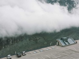
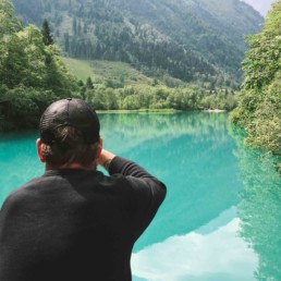
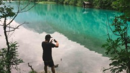
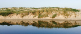
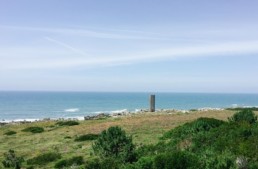
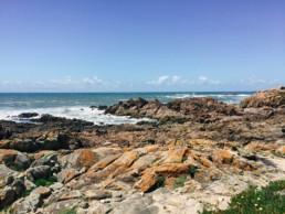
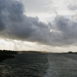
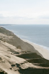
Rubjerg Knude is the highest point on the west coast of Vendsyssel. The cliff is 60 m high, on top of which is a migrating dune of up to 30 m in height. It has been created by the wind tearing grains of sand from the cliff and blowing them up over the edge of the cliff, where they are then deposited.
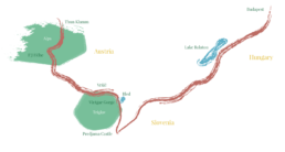
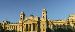
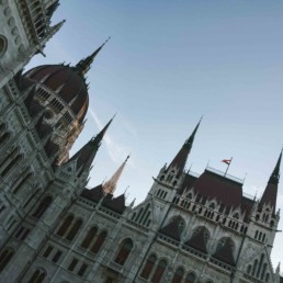
Hungary
Budapest & Lake Balaton
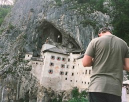
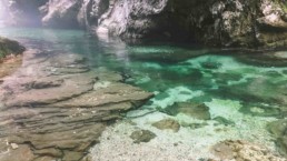
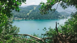
Slovenia
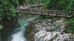
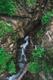
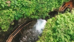
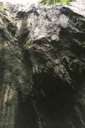
Predjama Castle & Cave, Vintgar Gorge, Bled, Vršič
The most comfortable and quick way to reach the top of Kriváň starts at the point called Tri studničky. The first serpentines of the green-marked footpath bring tourists to a place called Grúnik, which witnessed some bitter fighting between the partisans and the Nazi troops at the end of the Second World War. The path goes on from Grúnik crossing the slope of the Priehyba Mt. to a steep trough covered by falling debris from the Kriváň.
Not the most comfortable place to sleep, but it was worth it for the view.
An exceptionally attractive trip is the ascent to the Kriváň Mt. (2,494 m ) a stout peak in the western part of the High Tatras. This mountain is a multiple winner of enquiries about the mountain in Slovakia. It is easily recognisable for its conspicuously curved summit, which is the reason why it is called Kriváň (in English Curved Mount).
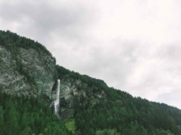
Austria
Franz-Josefs-Höhe & Thun Klamm
The End.
share if you like
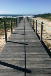
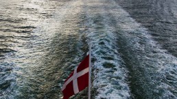
On the road to Santiago II
Caminho Português da Costa
Chapter II / III
“A dominant impulse on encountering beauty is to wish to hold on to it, to possess it and give it weight in one’s life. There is an urge to say, ‘I was here, I saw this and it mattered to me.”― Alain de Botton, The Art of Travel
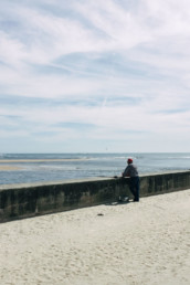
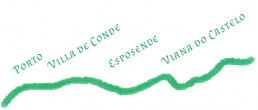
Day IIIEsposende → Belinho
61.3/256 km

Day IVBelinho → Viana do Castelo
75.9/256 km
Day VViana do Castelo → Vila Praia de Âncora
96.3/256 km
Day VIVila Praia de Âncora → A Riña
115.7/256 km
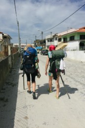
Cheaters! Our only transportation, which we used between borders of Portugal and Spain.
Chapter III.
coming soon…
Východná Vysoká
Hiking through Slovakian High Tatras
Chapter I / I
An exceptionally attractive trip is the ascent to the Kriváň Mt. (2,494 m ) a stout peak in the western part of the High Tatras. This mountain is a multiple winner of enquiries about the mountain in Slovakia. It is easily recognisable for its conspicuously curved summit, which is the reason why it is called Kriváň (in English Curved Mount).
The most comfortable and quick way to reach the top of Kriváň starts at the point called Tri studničky. The first serpentines of the green-marked footpath bring tourists to a place called Grúnik, which witnessed some bitter fighting between the partisans and the Nazi troops at the end of the Second World War. The path goes on from Grúnik crossing the slope of the Priehyba Mt. to a steep trough covered by falling debris from the Kriváň.
An exceptionally attractive trip is the ascent to the Kriváň Mt. (2,494 m ) a stout peak in the western part of the High Tatras. This mountain is a multiple winner of enquiries about the mountain in Slovakia. It is easily recognisable for its conspicuously curved summit, which is the reason why it is called Kriváň (in English Curved Mount).
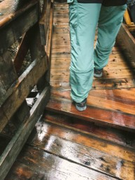
Not the most comfortable place to sleep, but it was worth it for the view.
The last bits of the snow for this year.
Not the most comfortable place to sleep, but it was worth it for the view.
The End.
share if you like
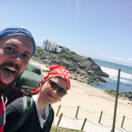
On the road to Santiago I
Caminho Português da Costa
Chapter I / III
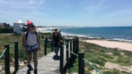
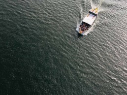
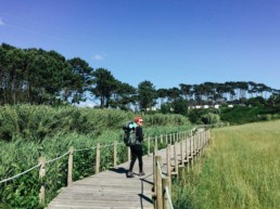
The Portuguese Coastal Camino or Caminho da Senda Litoral is an alternative route of the Portuguese Camino de Santiago. Following the Atlantic Coast towards Santiago de Compostela, the Portuguese Coastal Way starts in the city Porto and will take us through charming seaside towns and villages in Northern Portugal.
first part of our camping places
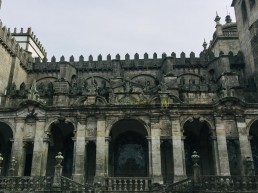
Porto
0/256 km
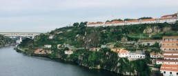
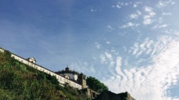
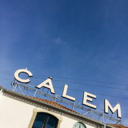
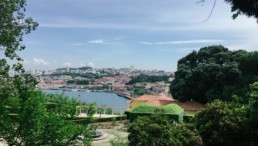
Porto is a historic city, from the narrow streets that make up the ancient Ribeira district through to the grand plazas of the Avenida dos Aliados. The region is famed for the production of Port, which is still stored in the cellars that stretch along the banks of the Douro River.
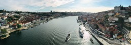
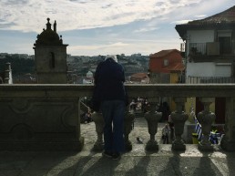
Getting lost in the town is beautiful, you don’t know what to expect at the next corner of the building.
Day IMatosinhos, Porto → Vila de Conde
23.6/256 km
Day II Vila de Conde → Esposende
45.9/256 km
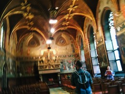
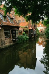
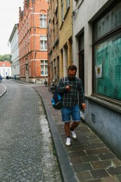
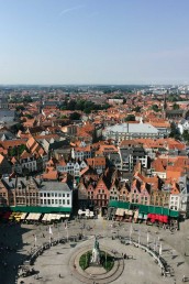
In Bruges
Drinking in Bruges, Belgium
Chapter I / I
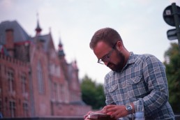
What can I say about the Bruges? Mornings were tough and the day time was blurrier and blurrier. Just saying that be careful with the beer, or maybe not. The canal, the city, the beer..oh the beer. It’s way too tempting to drink it all (impossible). There is way too many of them to taste. Just deciding to buy some is painful, to drink most of them in just two days will keep you drunk for some time.
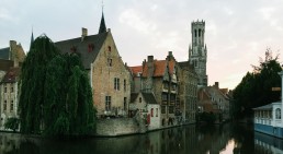
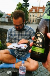
They say that Bruges is a romantic city, but for me was more interesting how many people get wasted drinking by the canal. Getting loaded by the canal is a proper beer romance.
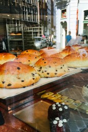
Coffee and this chocolate chip bun from Aux Merveilleux saved our mornings.
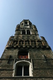
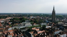
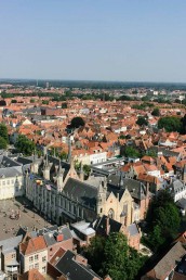
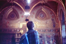
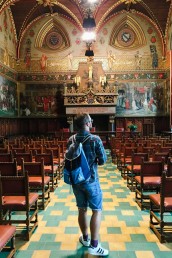
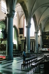
48 hours of museums and all the touristy stuff.
There are many places to visit, but we wanted to go on a boat trip, see the view from The Belfry and the Groeninge museum. By itself, it would cost more than the pass. The two-day pass, which cost around 40 euros let you explore all the museums and exhibitions. I’ve never felt so touristy in my life, but you can survive that while you’re drunk.
The End.
share if you like
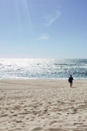
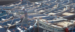
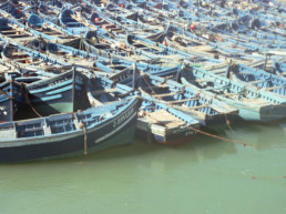
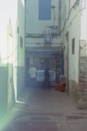
Alienated Africa
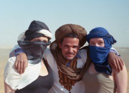
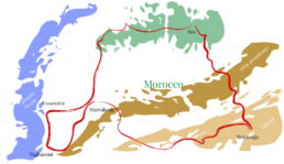
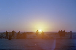
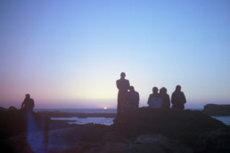
Chasing the lights of Morocco
Chapter I / I
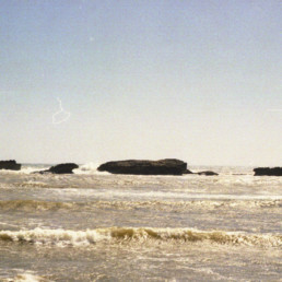
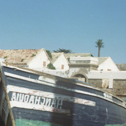
An exceptionally attractive trip is the ascent to the Kriváň Mt. (2,494 m ) a stout peak in the western part of the High Tatras. This mountain is a multiple winner of enquiries about the mountain in Slovakia. It is easily recognisable for its conspicuously curved summit, which is the reason why it is called Kriváň (in English Curved Mount).
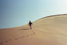
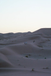
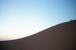
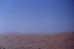
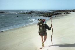
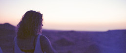
That feeling of the alienated world is just on eyesight.
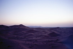
The most comfortable and quick way to reach the top of Kriváň starts at the point called Tri studničky. The first serpentines of the green-marked footpath bring tourists to a place called Grúnik, which witnessed some bitter fighting between the partisans and the Nazi troops at the end of the Second World War. The path goes on from Grúnik crossing the slope of the Priehyba Mt. to a steep trough covered by falling debris from the Kriváň.
An exceptionally attractive trip is the ascent to the Kriváň Mt. (2,494 m ) a stout peak in the western part of the High Tatras. This mountain is a multiple winner of enquiries about the mountain in Slovakia. It is easily recognisable for its conspicuously curved summit, which is the reason why it is called Kriváň (in English Curved Mount).
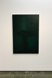
The last bits of the snow for this year.
The End.
share if you like
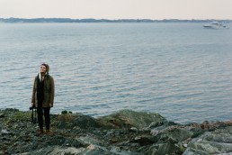
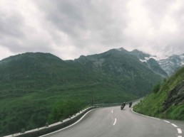
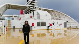
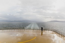
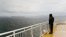
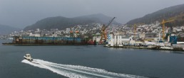
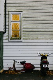
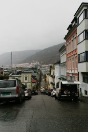
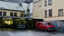
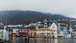
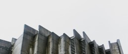
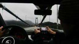
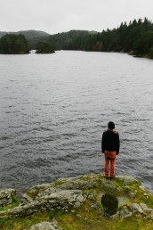
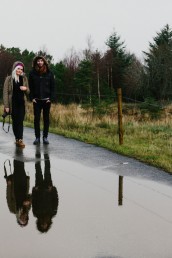
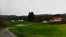
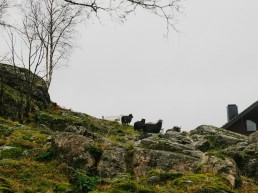
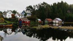
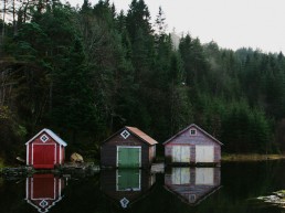
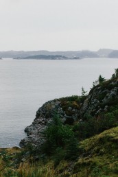
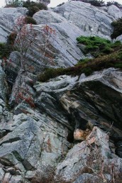
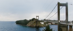
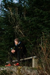
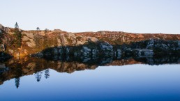
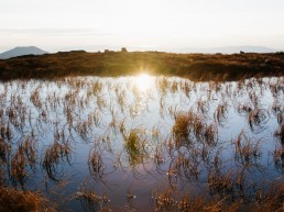
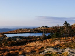
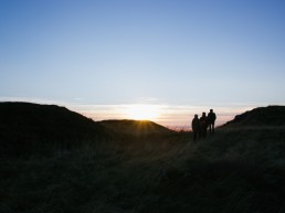
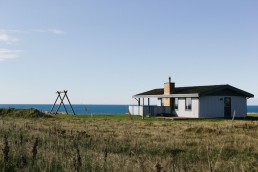
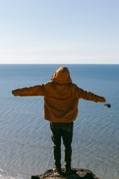
Bergen
Tripping in Askøy, Norway
Chapter I / I
Rubjerg Knude is the highest point on the west coast of Vendsyssel. The cliff is 60 m high, on top of which is a migrating dune of up to 30 m in height. It has been created by the wind tearing grains of sand from the cliff and blowing them up over the edge of the cliff, where they are then deposited.
The most comfortable and quick way to reach the top of Kriváň starts at the point called Tri studničky. The first serpentines of the green-marked footpath bring tourists to a place called Grúnik, which witnessed some bitter fighting between the partisans and the Nazi troops at the end of the Second World War. The path goes on from Grúnik crossing the slope of the Priehyba Mt. to a steep trough covered by falling debris from the Kriváň.
Not the most comfortable place to sleep, but it was worth it for the view.
Not the most comfortable place to sleep, but it was worth it for the view.
An exceptionally attractive trip is the ascent to the Kriváň Mt. (2,494 m ) a stout peak in the western part of the High Tatras. This mountain is a multiple winner of enquiries about the mountain in Slovakia. It is easily recognisable for its conspicuously curved summit, which is the reason why it is called Kriváň (in English Curved Mount).
An exceptionally attractive trip is the ascent to the Kriváň Mt. (2,494 m ) a stout peak in the western part of the High Tatras. This mountain is a multiple winner of enquiries about the mountain in Slovakia. It is easily recognisable for its conspicuously curved summit, which is the reason why it is called Kriváň (in English Curved Mount).
The End.
share if you like
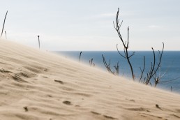
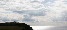
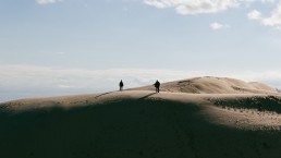
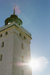
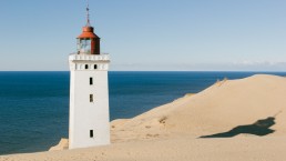
Rubjerg Knude Lighthouse
Walking on the Lønstrup dunes, Denmark
Chapter I / I
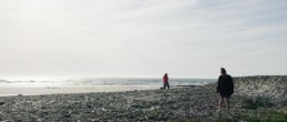
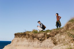
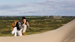
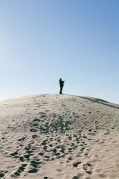
It’s a hard to catch a nice day in Denmark for a walk, but when the days come (probably once or twice a year) it’s worth it… When that day comes up I totally recommend seeing —soon to be destroyed Rubjerg Knude Lighthouse.
We’ve started to walk from small town called Lønstrup, which is 4km away from the cliff.
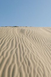
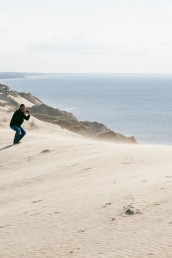
Denmark is a flat country, considering that the highest “mountain” is 170m tall. That’s why you can be happy for Rubjerg Knot, which is the highest point on the west coast of Vendsyssel. The cliff is 60m high and on top of it is a water slide up to 30m.
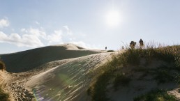
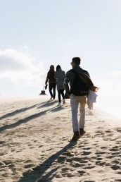
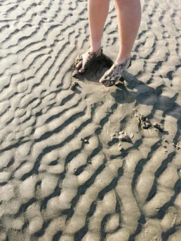
At some point, you may even stop thinking you actually are in Denmark! Enjoying the weather, nature, stare at sea or climbing the dunes bare foot.
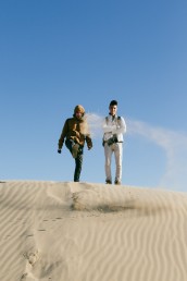
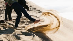
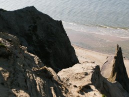
Back in the days when Rubjerg Knot Lighthouse was built (1899), the highest place was chosen 200m inland. But nature gradually showed the power. The wind and the ocean have broken down the cliff, so the lighthouse is only a few meters from the edge. It is created by the wind blowing loose sand grains from the cliff.
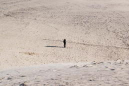
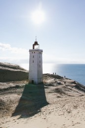
The lighthouse is the last building to remain standing against the sand, but not for long. The lighthouse will within the next 10-15 year fall into the sea because of coastal erosion.
The End.
share if you like